Storm Goretti
Development
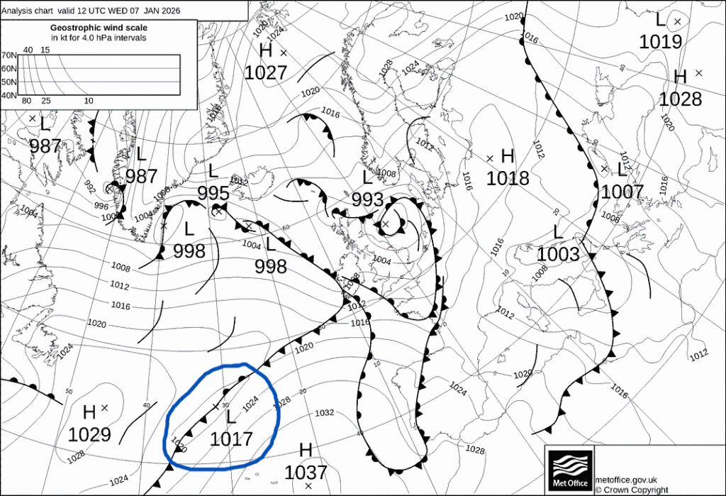
On the 6th of January 2026, a low-pressure system began to develop out in the Atlantic. Starting off at ~1020 hPa, it was named Storm Goretti by Météo-France, as the most severe wind impacts were initially forecast for northern France. The low was pushed above the Azores high block, with its trajectory towards the Channel. By midday on the 7th of January, the low (shown in the blue ring below) deepened to 1017 hPa, and the Met Office issued Yellow and Amber weather warnings for wind, rain, snow and ice for large areas of the UK.
Main event
At midnight (00:00) on the 8th of January, the low deepened to 1006 hPa and was strengthening rapidly, losing 2 hPa every hour, reaching 994 hPa by 06:00. Due to its strength and trajectory, the Met Office upgraded their warnings to include a red warning for the Isles of Scilly and parts of Cornwall, and several amber warnings for western parts of the country and the Midlands.
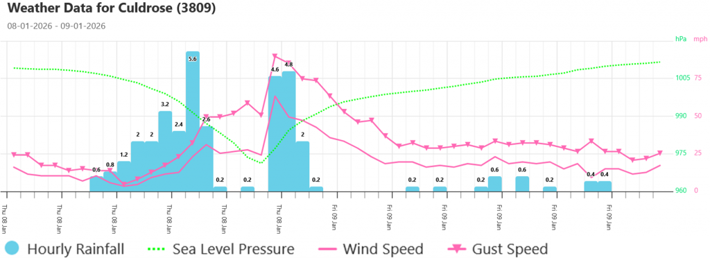
By the evening, the storm travelled directly over Cornwall, with peak winds of 99 mph being recorded at St Mary’s Airport on the Isles of Scilly. The time series from Culdrose weather station, Cornwall, shows how sudden the drop in pressure was, reaching a low of 969 hPa, with the leading rain before and sharp wind gusts just after the centre of the low passed overhead. The highest wind gust recorded at this station was 90 mph.
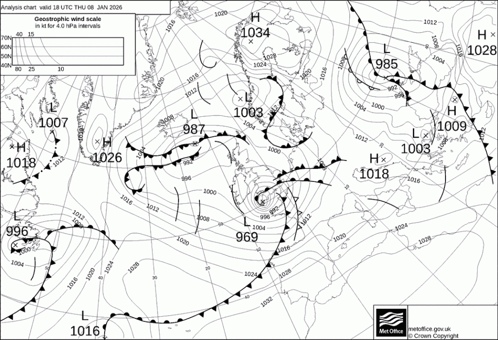
The damaging high wind speeds can be explained not only by the position of the low, but also by the type; Strom Goretti was a textbook Shapiro-Keyser style cyclone. During a Shapiro-Keyser storm’s development, the cold front detaches from the leading warm front, allowing cool air from behind the cold front to rapidly sink, accelerate and wrap around warm front, potentially creating a sting jet of intense wind speeds. This detachment can be seen in the pressure chart for 18UTC on the 8th of January.
While the Southwest saw the brunt of the strong winds and rough seas along the coast, large amounts of snow fell across parts of northern England, Wales and the Midlands. Values ranged from 8cm at Nottingham, up to unofficial reports of >20cm over high ground. Across the South and the East, the main impact was a prolonged spell of rainfall. See the WQ Radar video below for a snapshot of the event.
Disruption
Winter windstorms can be very dangerous, and Goretti was a severe case. Below are just a few impacts the storm caused:
- A man was unfortunately killed when a tree fell on his caravan in Helston.
- >200,000 properties without power, 12,000 of which were still without power on Sunday the 11th.
- The snow, combined with the mild weather after the storm meant there were many flood warnings and alerts in place all over the country.
- Water mains pipes damaged by uprooting trees and freeze-thaw bursts, leaving around 30,000 properties without water.
- Flights were cancelled and airports were shut down across the country.
- Some cars and vans were overturned on some main roads.
We hope everyone stays safe during the storm season!
For more information about