25 Weather Events for the 25 years of WeatherQuest
Twenty-five years is a long time in weather forecasting — and an extraordinary amount of weather can happen in that time. Since WeatherQuest began, the UK has experienced record-breaking heat, exceptional rainfall, damaging storms, severe cold, drought, flooding and major changes in how extreme weather is forecast and communicated. To mark WeatherQuest’s 25th anniversary, we have chosen standout weather events from each year between 2001 and 2026: a timeline of memorable moments that affected communities, businesses and, in many cases, our clients too.
2001
In 2001, the UK recorded its sunniest December on record, averaging 64 hours of bright sunshine. England and Wales were sunnier still, with an average of 80.6 hours — around 2.6 hours per day. Despite the sunshine, temperatures were nearly 1°C below average, and the month ended with several severe frosts.
2002
October 2002 was an exceptionally stormy month for the UK, with several significant weather events occurring in quick succession. On the 13th, the southwest was worst affected, with 24-hour rainfall totals reaching up to 70 mm. Just two days later, on the 15th, eastern areas recorded around 40–50 mm of rain (alongside numerous reports of tornadoes), and in Marham, 36 mm fell in just five hours. Powerful winds followed later in the month, with a gust of 102 mph recorded on the Isle of Wight on the 27th.
2003
In August 2003, a major heatwave developed across Europe, bringing widespread and severe impacts. In the UK, it produced the national maximum temperature record of 38.5°C at Faversham, Kent, which remained for many years. Across continental Europe, prolonged heat and a lack of rainfall led to numerous forest fires and caused river levels to fall to exceptionally low levels. The human impact was devastating, with more than 20,000 deaths across Europe, with around 15,000 in France alone. In response to the 2,000 deaths in the UK, Heat Health Alerts were created to help warn communities and services during periods of extreme heat.
https://weather.metoffice.gov.uk/learn-about/weather/case-studies/heatwave
2004
On August the 16th, exceptionally heavy and localised rainfall affected northern Cornwall. At Trevalec, Lesnewth, 181 mm of rain fell in just three hours. With the ground already saturated from earlier summer rainfall, little of the rain could soak in, leading to rapid run-off across local river catchments. The River Valency rose suddenly, burst its banks and flooded the village of Boscastle. In total, 58 properties were flooded, but no lives were lost thanks to a major helicopter rescue operation.

2005
On the 28th of July in 2005, supercell thunderstorms developed across the Midlands, triggered by a shallow depression just off southwest Cornwall. Slow-moving warm and cold fronts, combined with warm air advected from Spain aloft, created highly unstable conditions. Strong wind shear then helped several tornadoes to form. The most damaging was an IF3 tornado in Birmingham, which tore through neighbourhoods, ripping roofs from buildings, blowing out windows, overturning cars and uprooting trees. Despite the scale of the damage, there were no fatalities.
2006
During the widespread European heatwave of July 2006, the UK recorded its warmest calendar month on record. Average daily maximum temperatures exceeded 26°C across the month, and the mean Central England Temperature was just under 1.5°C above the 1961–1990 average. Many weather stations also broke the record for their hottest July day on the 19th, particularly in Wales. July 2006 also marked the end of a very dry period that had begun in November 2004, with rainfall across much of southern England remaining below 80% of average during that time.
2007
Very intense rainfall affected the Midlands during July 2007, with more than 200 mm falling across parts of Oxfordshire, Herefordshire, Worcestershire and Gloucestershire. In Tewkesbury, this amounted to over 500% of the average July rainfall. With the ground already saturated, much of the rain collected on fields and floodplains or flowed directly into rivers, causing widespread flooding. Located at the confluence of the Rivers Avon and Severn, Tewkesbury received water from both catchments, resulting in severe flooding which at their height cut off all road access to the town.

2008
Many weather stations across the UK set new records for their lowest October maximum and minimum temperatures. The coldest temperature recorded was -4.2°C at Coningsby, Lincolnshire, whilst the UK average maximum temperature was just 5.6°C. Snow and sleet were also reported during the cold spell, with lying snow observed at 9 am on the 29th of October at numerous weather stations across Southeast and Central Southern England.
2009
From the 2nd to the 6th of February 2009, large amounts of snow fell across the UK. The Southeast was impacted first on the 2nd, with lying snow depths reported widely in the teens, with certain stations having up to 29 cm. This halted all London buses and closed runways at Heathrow. On the 3rd and 5th the snow moved further north, impacting much of Wales, the Midlands, the North and Scotland, leading to many school closures and worries of salt/gravel shortages. Then on the 6th, the snow moved back southwards, leaving 12,000 Devon homes without power!
2010
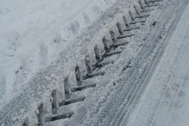
2010 was bookended by very cold and wintry conditions. From the 17th of December 2009 to the 15th of January 2010, freezing temperatures and widespread snowfall were experienced by much of the country. On the 4th of January, Manchester and Liverpool airports were closed due to snow, while further snowfall overnight on the 5th/6th left around 1,000 motorists stranded on the A3. Then from the 25th of November 2006, a spell of bitterly cold air from Siberia brought heavy snowfall to northeast England and Scotland, with accumulations reaching 50 cm in some areas. Temperatures fell below -10°C on several nights and dropped below -20°C in some locations. A further cold spell beginning on the 16th of December lasted until Boxing Day, bringing further snow and ice. The full November to December period caused major disruption, stranding motorists, closing airports and bringing down power lines. Heathrow Airport was forced to close during one of the busiest travel periods of the year.
Another well-known event occurred in April 2010, when the eruption of Eyjafjallajökull in Iceland caused widespread disruption to European air travel. Volcanic ash was carried southeastwards across European airspace, forcing large numbers of flights to be cancelled and leaving many holidaymakers stranded abroad until conditions were considered safe for flying again!
2011
Not long after the aforementioned December cold spell, Spring 2011 was very warm. With rain limited to the north and west of the country, across East Anglia and the Southeast, less than 30% of the average rainfall fell. This resulted in very low river levels and wildfires across the country. Overall, the mean temperature anomaly for the Spring was above 1.5°C for most of the UK, and above 2°C in the East. This led to Spring 2006 being the warmest in over 100 years.
2012
Heavy rainfall between April and July brought an abrupt end to the prolonged 2010–2012 drought, allowing many hosepipe bans to be lifted. Although the rain was initially welcomed, the sheer volume soon left the ground waterlogged, contributing to crop failures, transport-disrupting surface-water flooding, landslides and cliff collapses. Honister Pass in Cumbria recorded the highest one-day rainfall total during this period, with 208 mm. Despite the persistent wet weather and widespread disruption, the rain did not manage to stop the Olympic Torch Relay!
2013
A very powerful jet stream in December led to an incredibly stormy month for the UK, with five storms hitting the country from the 5th December to the 3rd of January 2014. The first storm on the 5th of December brought strong winds to Scotland and a large coastal storm surge to the North Sea. Flights were cancelled at all major Scottish airports, 100,000 homes lost power and trees were felled. Houses were flooded in Lincolnshire, cliffs eroded in Norfolk causing several properties to fall into the sea and the Thames barrier had to close. The next storm arrived on the 18th and 19th of December, but with lesser impacts. The storm on the 23rd and 24th was located further south, leaving 50,000 homes across southern England without power during the Christmas period. Three more storms arrived on the 26th-27th, 30th-31st, and the 3rd of January. Unfortunately, during the whole period there were 7 fatalities.
2014
On the 10th and 11th of August, ex-hurricane Bertha brought havoc across Scotland and parts of the East of England. Mass amounts of flooding occurred in northeast Scotland, where around double the average August rainfall fell across the two days, damaging roads and forcing the evacuation of some affected homes. The amount of rainfall from the ex-hurricane meant that August 2014 was the wettest for Northern Scotland in a series starting from 1910. Although wind speeds were high (~60 mph for non-mountain stations), the main impacts were from the sheer volume of precipitation that fell.
2015
The Met Office, in partnership with Met Éireann, introduced the Named Storms Initiative to provide clear, consistent and authoritative communication ahead of severe weather. Naming individual storms helps keep information focused and easier to follow, allowing the public to stay informed, take appropriate action and, most importantly, remain safe. To keep in line with international Hurricane naming convention, the letters Q, U, X, Y, and Z are never used. The first storm to be officially named under the initiative was Storm Abigail on the 10th of November.
https://www.metoffice.gov.uk/blog/2025/how-does-the-met-office-name-storms

2016
On the 13th of September an area of low pressure situated over the Bay of Biscay produced a very light southerly airflow across the UK. This brought exceptionally high temperatures for the time of year, particularly across eastern areas. Gravesend in Kent recorded 34.4°C, the highest September temperature in the UK since 1911 and also the highest temperature recorded during 2016. Troughs associated with the weather pattern, combined with the warm and humid southerly airflow, triggered widespread thunderstorms. These produced intense downpours and flash flooding, with several locations recording more than 30 mm of rainfall within an hour.
2017
Ex-Hurricane Ophelia passed over the UK on the 16th of October, bringing the strongest winds to western areas. Gusts reached around 90 mph in Wales and 97 mph in the Republic of Ireland. The impacts were severe, with three people in Ireland sadly killed by falling trees. Across western parts of the UK, power lines were brought down, buildings were damaged, flights were diverted and railway services were disrupted. In southeast England, conditions were much milder and more settled. Ophelia also carried Saharan dust and smoke from wildfires in Iberia northwards, producing an unusual red sun and yellow-orange sky in areas where skies remained clear.
2018
Despite only lasting for around four days, the cold spell at the end of February and into early March became cemented in the public eye as a ‘Beast from the East’. A ‘Beast from the East’ is a type of meteorological set-up where a high pressure block sits over Scandinavia during winter months. This causes very cold and dry air to flow into the UK from the very cold parts of continental Europe (Siberia and the Baltics). This pattern occurred at the start of March in 2018 and brought temperatures of below -10°C and widespread snowfall, leading to disruption across the UK. Roads became blocked and unpassable, stranding motorists, communities across the North Pennines were cut-off and isolated, requiring supplies from helicopters, and many areas suffered power cuts, with thousands of schools forced to closed across the country. Unfortunately, a man died after falling into a lake in London.
https://weather.metoffice.gov.uk/learn-about/weather/atmosphere/beast-from-the-east
2019
Before the start of the 2019/2020 storm season, KNMI, the Dutch national meteorological service joined the Met Office and Met Éireann as part of the Western Storm Naming group. The names of the storms are suggested by the public, and every season the list contains a mixture of names from each country. The first named storm of this season was Storm Atiyah, which mainly impacted Ireland.
2020
During the spring of 2020, following the wettest February on record and coinciding with the first UK national Covid lockdown, the weather was incredibly dry and sunny. Dominated by successive high pressure systems, the weather was incredibly settled leading to all UK countries recording their sunniest springs on record, with the national value at 626.2 hours of sunshine.

2021
The Met Office introduced the Extreme Heat warning index at the start of June 2021. Much like the other warning matrices from the Met Office, this focuses on the likelihood and the severity of the impacts, providing either an Amber or Red warning. The alerts aim to provide clear communication ahead of extreme heat, allowing the public to take appropriate action. The first Amber alert was issued a few days after, for the 19th – 22nd of July. Before these alerts, heat warnings were only issued to those working in the health/public sector by Public Health England.
2022
Just a year after the first ever Amber Extreme Heat Warning, the Met Office issued a Red Extreme Heat Warning for the 18th and 19th of July. On the 19th, temperatures breached 40 °C in the UK for the first time in recorded history, reaching 40.3°C at Coningsby, Lincolnshire. The temperatures led to many food stock issues with retailers, as well as transport disruption due to melting of roads and runways and warping of rail.
2023
The 2023/2024 storm season was the stormiest since the introduction of storm names in 2015. Driven by a very strong jet stream, twelve named storms hit the UK over the September 2023- August 2024 period. In fact, on the arrival of storm Henk on the 2nd of January 2024, it was the earliest time the letter ‘H’ had been reached within a storm season. By the end of January 2024, 10 named storms had been experienced within the UK, with only two more occurring for the rest of the season.
https://www.metoffice.gov.uk/blog/2024/looking-back-on-a-storm-laden-season
2024
Spring 2024 was the warmest on record, with the mean temperature being 9.37°C, 1.3°C warmer than the 1991-2020 average. Accompanied by very low sunshine totals, the seasonal average was primarily influenced by high minimum/overnight temperatures (1.64°C warmer than average). This was most likely due to the increased amount of cloud cover acting as a blanket reducing the number of frost events, and those very chilly spring mornings. Rainfall totals were also rather high, resulting in the spring being the sixth wettest on record.
2025
Similar to 2024, spring 2025 was once again incredibly warm, due to incredibly dominant and persistent high pressure patterns over the UK. This time however, the spring mean temperatures were driven by very high maximums (2.4°C above the average), with minimums remaining around average. Of the three spring months, April was the warmest with the entire country between 2.5°C and 3.5°C above the average. Other than the marine heatwave, one main driver for the high maximum temperatures was the sheer amount of sunshine received by the UK. The high pressure dominance meant the weather was incredibly settled, leading to many days of bright sunshine, totalling 653.3 hours (27.1 hours more than 2020). In contrast to 2024, rainfall totals were rather low, making 2025 the sixth driest spring on record.

2026
Throughout the spring and summer of 2026, the UK experienced five major heatwaves, breaking numerous temperature records. The late-May heatwave set a new national maximum temperature record for May, reaching 35.1°C at Kew Gardens. Overnight temperatures were also exceptionally high, with Camborne, Cornwall, recording a new May minimum temperature record of 21.4°C. This also marked the earliest occurrence of a ‘tropical night’ in the UK.
Another extreme heatwave developed during the latter half of June, prompting a three-day Red Extreme Heat Warning across southeast England. On the 26th of June, new UK June temperature records were set, when Lingwood in Norfolk reached a daytime maximum of 38.0°C, and Hastings recorded an overnight minimum of 23.2°C.
Alongside the exceptional heat, July was remarkably dry, with much of England and Wales receiving less than 10% of the average monthly rainfall. Some areas of southern England recorded barely 5 mm of rain between mid-June and mid-August. Combined with the prolonged high temperatures, these exceptionally dry conditions contributed to wildfires across the country.
Much of the details from this post was found from the Past UK Weather Events Website from the Met Office:
https://weather.metoffice.gov.uk/learn-about/past-uk-weather-events