Lightning has been detected!
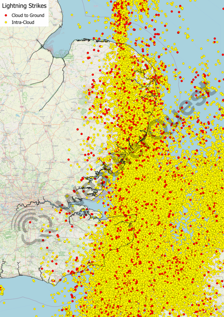
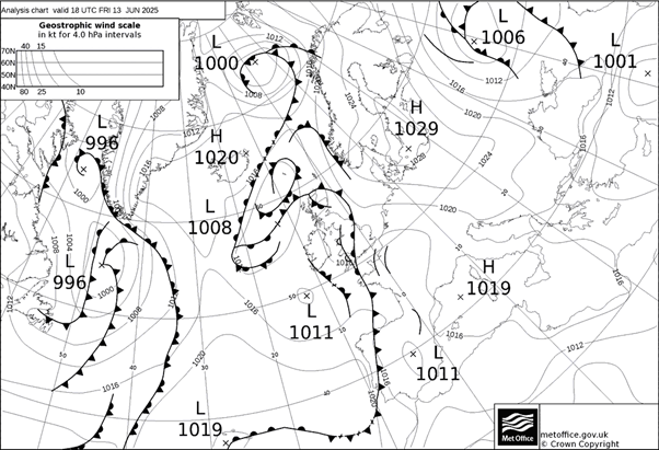
On Friday the 13th of June 2025, the low pressure system located to the West of Ireland set up strong southerly flow of warm and humid air which destabilised over Northwest Europe, releasing substantial amounts of Convective Available Potential Energy (CAPE). The resulting convective system produced frequent lightning and travelled over Nantes and into Normandie, before following the coastline of Northern France. It then travelled north over the Channel, hitting areas of Kent and East Anglia.
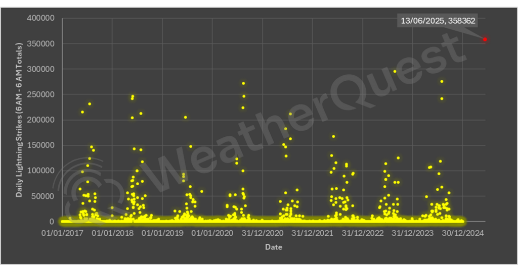
Using lightning data from METEORAGE, in the 24-hour period of 06:00 13/06/2025 to 06:00 14/06/2025, there were 358,362 strikes recorded in WeatherQuest’s custom domain, which covers areas of Northern France and the British Isles. This was the most amount of recorded lightning in the domain since our records began, over 63,000 more than the second most active 24-hours.
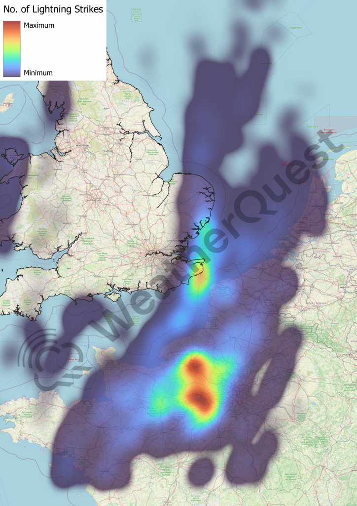
There are two different types of lightning, Intra-Cloud (IC) and Cloud-to-Ground (CG). Intra-cloud means that the lightning did not reach earth but instead struck through the cloud itself. Determining the type of lightning strike is achieved by analysing its electromagnetic signal discharge, with IC and CG both having different signals. The lightning during this 24-hour period was mainly IC (93% of total), but despite this, 25,621 strikes were CG, a quarter of which happened over the French city of Rouen, and its surrounding area (see the heat map above)!