Cirrus Clouds
Up next in our dive into our favourite weather phenomena for our 25th anniversary is cirrus clouds!
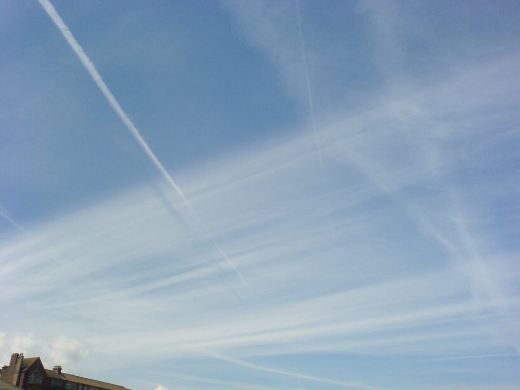
Cirrus clouds are one of the highest types of cloud, located at around 6 – 12 km above the earth’s surface. They are formed when dry air rises, and what little water vapour is held by it undergoes deposition, changing directly from a gas to a solid (ice crystals) [1]. This is catalysed by the presence of mineral dust, metallic particles and organic aerosols acting as nucleation points for the ice crystals [2]. The crystallisation is often caused when a warm front meets a cold air mass, as they interact first at high altitude. This means cirrus clouds can be a sign that there will be a change in the weather [1]. After these ice crystals form, they are blown by the very high winds felt at these altitudes. This is what causes them to have the appearance of very wispy hair/frayed string, with “Cirrus” being a Latin word that means lock/curl of hair [3]. Sometimes the ice crystals can precipitate out of the clouds, but they re-evaporate before reaching the surface, producing something called virga (also called jellyfish clouds) [1]. Due to their thinness and composition, cirrus clouds can produce some bright colours during sunset and can even produce some optical phenomena (more on this in an upcoming post from us).
Due to the height the water vapour is required to reach before forming into ice crystals there are a few other ways in which this type of cloud can form. Contrails are the tails of frozen water vapour left from jet engines when flying through high and dry tropospheric air. These contrails slowly expand and can form an artificial type of cirrus cloud [1]. Thunderstorms can also produce cirrus clouds, as the high energy convection can thrust moisture high enough to form the ice crystals. This can also be seen in tropical cyclones (hurricanes and typhoons), as the outflowing winds at the top of the cyclone provide moisture and condensation nuclei at the 6 – 12 km altitude needed to produce cirrus clouds [4].
There are multiple categories of cirrus clouds [1]:
- Cirrus fibratus – The most common type, thin and fibrous in appearance.
- Cirrus uncinus – Wispy streaks of cloud with a characteristic hook shape, otherwise known as “Mare’s tails”.
- Cirrus spissatus – A large, thick and dense patch of cirrus which sits right at the top of the troposphere.
- Cirrus floccus – Isolated patches that look like torn tufts of cotton wool.
- Cirrus castellanus – Often a flat base with turret-like tops and taller than they are wide
If you would like learn some more about cirrus clouds, follow the references and links below:
[1] Met Office (2026). High clouds. Available at: https://weather.metoffice.gov.uk/learn-about/weather/types-of-weather/clouds/high-clouds (accessed: 12/05/2026)
[2] NOAA Chemical Sciences Laboratory (2013). The origins of cirrus: Earth’s highest clouds have a dusty core. Available at: https://csl.noaa.gov/news/2013/139_0509.html (accessed: 12/05/2026)
[3] Cloud Appreciation Society (2026). Cloud Library: Cirrus. Available at: https://cloudappreciationsociety.org/cloud-library/cirrus/ (accessed: 12/05/2026)
[4] NASA Jet Propulsion Laboratory (2012). NASA Spacecraft Image Shows Isaac’s Inflow and Outflow. Available at: https://www.jpl.nasa.gov/images/pia16017-nasa-spacecraft-image-shows-isaacs-inflow-and-outflow/ (accessed: 12/05/2026)