Weather forecasting: 25 years later

News / Weather forecasting: 25 years later

Changes in Meteorology

A lot has changed in the forecasting world since WeatherQuest’s inception, with massive advancements in technology, understanding of processes and number/availability of observations. In this article we will be going through just a few of these developments made within meteorology.
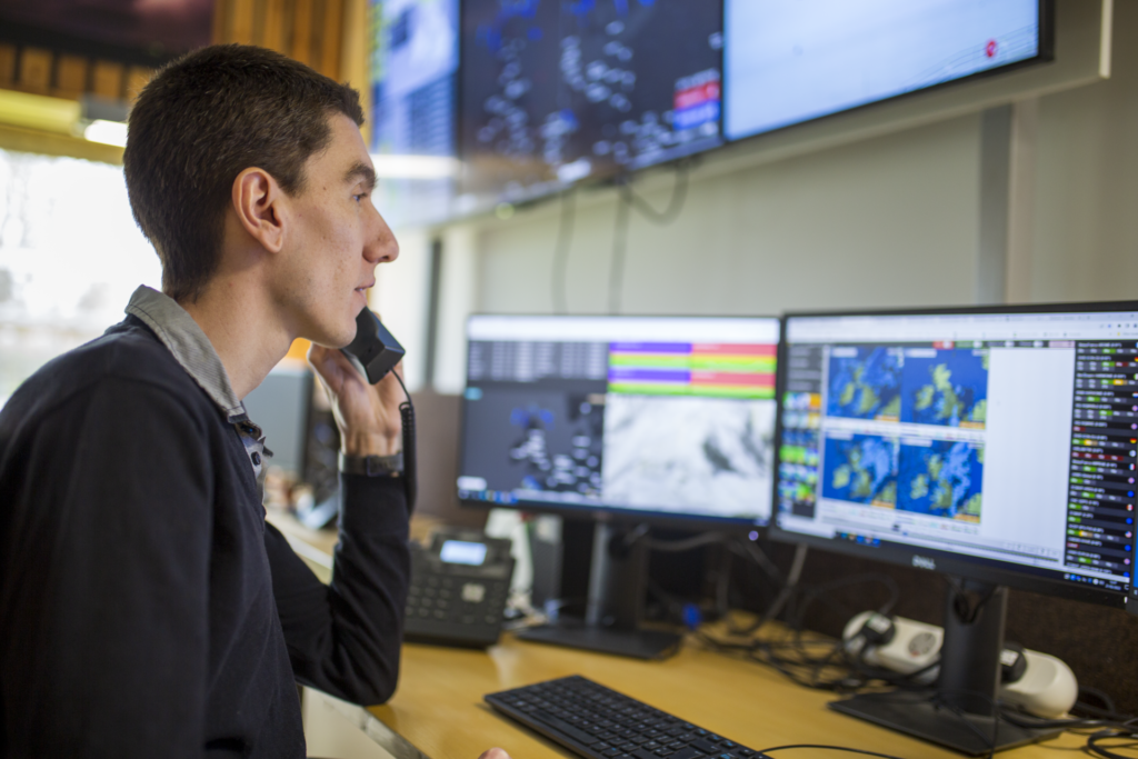
Forecasting

Numerical Weather Prediction Models

Numerical Weather Prediction (NWP) involves dividing the earth into a 3D grid and using supercomputers to ingest observations before running intricate mathematical models based on the dynamics and physics of the atmosphere. There are two main types of forecast model, Global and Regional. Global models produce a forecast for conditions over the whole earth at a relatively low resolution and are very useful for seeing large scale patterns and how they will develop. Regional models focus on smaller areas at a much higher resolution, enabling a much clearer localised forecast for users. WeatherQuest use both types of models, and depending on the location of our customer, our forecasters will look at multiple models to give the most accurate forecast they can.

Back in the late 90s and early 00s global models were limited to a spatial resolution of between ~60-90 km, with regional models reaching ~12-15 km. With advancements and improvements to all aspects of the process over the years, the current Met Office equivalent models now run at ~10 km and 1.5 km respectively, providing much greater spatial accuracy in forecasts. Models have since also been “coupled” with the earth system, integrating the physical interactions between the atmosphere, ocean, cryosphere and land surface and how they influence meteorological phenomena downstream, further increasing their accuracy. One example of this are convection-permitting models, which can be used to simulate the development of convective thunderstorms at incredibly fine spatial and temporal resolutions, aiding in rainfall/flood and lightning forecasting.

(Met Office, History of numerical weather prediction, 2026)

Ensemble Forecasting

Despite being first developed in the 1970s, ensemble forecasting has seen massive improvements over the last 25 years. An ensemble forecast works by combining multiple NWP models with slightly differing starting conditions, leading to a model spread of various likely weather outcomes. Where these outcomes more closely agree, there is higher confidence in the forecast for those specific conditions occurring. As computer power has increased, so has the ability to include more models and at higher resolutions into these ensembles. The European Centre for Medium-Range Weather Forecasting (ECMWF) is a world leading producer of ensemble forecasts, and back in the early nineties, their ensembles had 33 models and a resolution of 210 km. With many upgrades since then, the numbers now stand at 51 models with a resolution of 9 km, gaining a skilful forecast lead time of around 1.5 days every decade; the current 9-day ensemble forecast is as useful as the 5-day forecast was back in 1998. WeatherQuest use these ensembles for our forecasts beyond seven days, providing both the extremes and the most likely values for each day. We also use them for our monthly and subseasonal forecasts, stretching out to 28 days ahead.

(ECMWF, 2022)

Observations

Observations are one of the most important aspects of weather forecasting, with many different kinds used within the industry. Two vital applications of observations include providing current conditions for models to use in forecast runs and allowing forecast verification by comparing past forecasts to the observed conditions. WeatherQuest use observations daily to intervene on warnings, verify and edit our forecasts and produce climatologies for a wide range of customers. So, what’s changed?
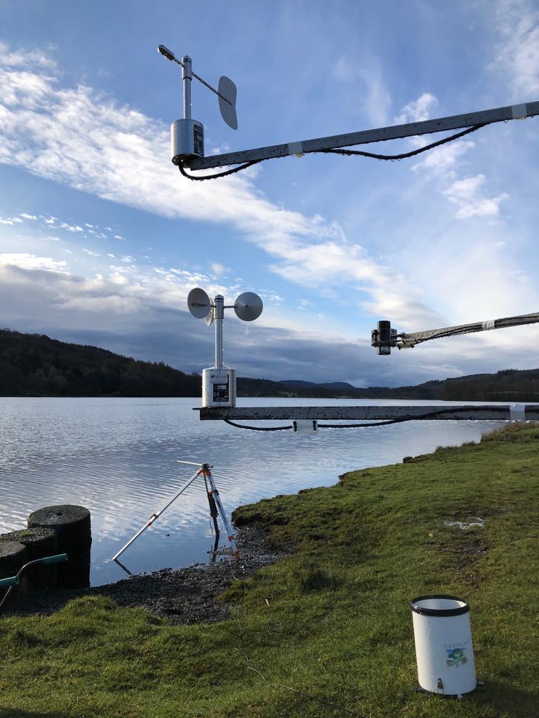
Stations

Many weather stations in the 90s were still relying on the manual logging of observations, where on-site staff would record the current conditions and enter them manually into a database. Since then, automated weather stations have become the norm, allowing for greater measurement frequency and reliability. Combining this with the fact that instruments and logging systems have undergone constant improvements, precision and accuracy has also increased. This has greatly helped in climatological studies and use of past weather data, ensuring a consistent and timely stream of weather conditions.

(Met Office, The UK land observation network, 2026)

Satellites

Since the 2000s there has also been a major increase in high resolution satellite observations, with the sector still making rapid and large developments today. They come in the form of Geostationary (a persistent picture of the same point above earth), and polar orbiting (providing swathes of images at much higher resolution) satellites, and can measure an ever-increasing array of variables. This helps cover some ground where land-based observations cannot be made. For example, large areas of Africa have seen little to no introduction of land-based stations, with some areas actually having a decline in station density. One of the simplest but most powerful tools is visible light satellite imagery (basically a near-live photo of the earth from space). This allows meteorologists to compare cloud patterns to real-time observations including rainfall, temperature and wind and increase confidence in their forecasts.

(Smith & Ward, 2025)

Radar

Radar was first introduced back in WW2 with the aim of detecting the location of enemy aircraft by pulsing out electro-magnetic waves and listening for an echo. After the war, the technology turned to focus on a more meteorological application of detecting precipitation. Initially the technology could only determine the location of the precipitation, but by the 1970s, doppler radars were installed across the UK. Doppler radars send out two short pulsed horizontally polarised electromagnetic waves, which bounce off any form of precipitation and return to the receiver. It then subtracts the second pulse from the first to determine not only the location, but also the intensity/rate of the precipitation.

Since the 00s, a new technology for radar has emerged, dual polarisation. Working in a similar way to doppler radars, dual polarisation radars also send out a vertical pulse. By using computer technology to combine both the horizontal and vertical, it forms a cross-section that can be used to determine precipitation type, and size. This also allows for better differentiation between precipitation and non-precipitation phenomena, and therefore the accuracy of the radar overall. WeatherQuest utilise radar data in our own WQRadar web application and in rainfall tracking sections on our client portals.

(Met Office, National Meteorological Library and Archive, 2023)

(NOAA National Severe Storms Laboratory, 2026)

Public Observations

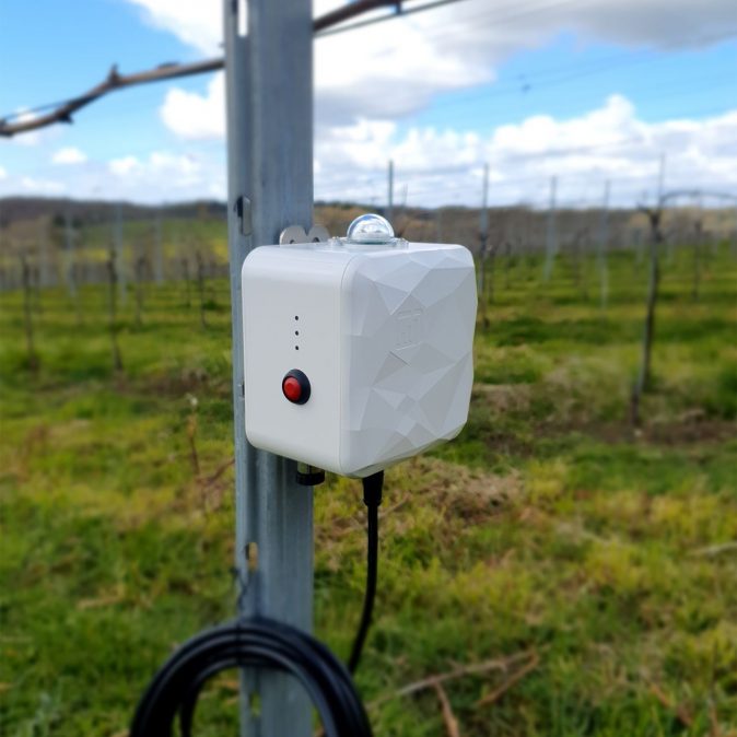
Weather stations have also become cheaper and more readily available, not just for companies and businesses, but also for the public. With many more people owning different weather sensors, public observations can therefore contribute to broader networks and help detect patterns in more localised weather. Despite this, it is incredibly difficult to verify public sensors, and so public networks can include unreliable observations. Public observations don’t have to involve sensors either, as with some simple instructions, reports can be made into many different citizen science projects. In fact, WeatherQuest uses public observations in our snow depth report map, to help the public see which areas in the UK have the deepest snow: https://weatherquest.co.uk/snowdepth/map.

Argo programme

One of the largest increases in global observations was the deployment of Argo floats, an array of temperature, salinity and current profiling buoys dotted around the world’s seas and oceans. Beginning in 1999, 3000 floats were deployed by November 2007, with the current number being around 4000 floats. Although the floats don’t measure surface air temperature, sea surface temperatures (SSTs) play one of the largest roles in generating and affecting our weather through ocean-atmosphere interactions. In fact, large-scale systems such as the El Niño Southern Oscillation (ENSO) are primarily driven by SSTs, and ENSO is known for affecting global temperatures and large-scale regional rainfall patterns. SSTs are also the driving force behind hurricanes/typhoons/tropical cyclones and more localised low pressure storms. With this SST data, forecasting at both mesoscale (1-1000 km) and synoptic scale (>1000 km) has become much more reliable and accurate.

(Argo Programme, 2026)

New Advances

There are many current large-scale developments occurring in the world of meteorology. Most notably (as with a lot of other sectors) is the integration of Artificial Intelligence (AI) and Machine Learning (ML) technologies. Although traditional models are physics-based, newer AI/ML models are trained on vast arrays of past data to determine patterns and relationships and use them in their forecasts. This means that AI/ML forecasts can be run faster and on significantly lower powered machinery with GPUs, instead of the large-scale supercomputer CPUs. This can allow meteorological agencies in developing countries to generate useful and accurate forecasts for their populace. In fact, it’s not just limited to countries and meteorological agencies, as some large companies including Google, Huawei and Nvidia have begun to produce deep learning models that produce forecasts. Many current AI/ML forecasts are beginning to become competitive in the short- to medium-range forecast period, whilst others provide long-term/climate based projections.

Where AI really shines in the world of meteorology is its use in nowcasting. To produce a nowcast, current high frequency observations/datasets (such as those from radar and satellites) and short-range forecasts are combined by models to produce a forecast for the conditions of the next 0-6 hours in a very high spatial resolution. This is extremely helpful for those working in disaster prevention and aid, generating far more accurate flood warnings or tornado path projection for example. Nowcasting could also be used by those whose operations are tied to conditions with exact cut-off thresholds, who want to operate as much as possible on very marginal days.

Although AI/ML forecasts are making huge advancements, our changing climate is a limitation. Models need to be trained on historical observations and as our weather becomes more extreme, into conditions not previously seen, AI/ML forecasts may not forecast these extreme conditions accurately, something traditional NWP models may be able to do. This is a great argument for why AI/ML forecasts are a great supplement to standard NWP models, and why both should continue to be developed as we head into the future.

(Jean, et al., 2025)

Conclusion

The field of meteorology is constantly evolving, and new insights, models, processes and datasets are always being studied and developed. With each new progression, more studies and applications appear, and before long a groundbreaking technique becomes the new norm.  So much has changed over the last 25 years, it is impossible to say where meteorology will be after the next 25, but wherever the sector is headed, WeatherQuest is eager to be there.

References

Argo Programme. (2026, May 12). Argo Program. Retrieved from NOAA AOML: https://www.aoml.noaa.gov/argo/

ECMWF. (2022, November 24). 30 years of ensemble forecasting at ECMWF. Retrieved from ECMWF Media Centre: https://www.ecmwf.int/en/about/media-centre/focus/2022/30-years-ensemble-forecasting-ecmwf

Jean, M., Pappenberger, F., Chan, P. W., Bouchet, V., Stav, N., & Honda, Y. (2025, October 13). Forecasting the Future: The Role of Artificial Intelligence in Transforming Weather Prediction and Policy. Retrieved from World Meteorological Organization: https://wmo.int/media/magazine-article/forecasting-future-role-of-artificial-intelligence-transforming-weather-prediction-and-policy

Met Office. (2023). National Meteorological Library and Archive. Retrieved from Met Office: https://www.metoffice.gov.uk/binaries/content/assets/metofficegovuk/pdf/research/library-and-archive/library/publications/factsheets/factsheet_15-weather-radar-2020_2023.pdf

Met Office. (2026, May 12). History of numerical weather prediction. Retrieved from Met Office: How weather forecasts are created: https://weather.metoffice.gov.uk/learn-about/how-forecasts-are-made/history-of-numerical-weather-prediction

Met Office. (2026, May 12). The UK land observation network. Retrieved from Met Office: https://weather.metoffice.gov.uk/guides/observations/uk-observations-network

NOAA National Severe Storms Laboratory. (2026, May 12). Research Tools: Dual Polarized Radar. Retrieved from NOAA NSSL: https://www.nssl.noaa.gov/tools/radar/dualpol/

Smith, M., & Ward, A. (2025, December 22). Sentinels in the Sky: 50 Years of GOES Satellite Observations. Retrieved from NASA: https://science.nasa.gov/science-research/earth-science/sentinels-in-the-sky-50-years-of-goes-satellite-observations/

To find out more about our Forecasting Services

Registered and Chartered Meteorologists!

News / Professional Accreditation from RMetS

Royal Meteorological Society Professional Accreditation

We are incredibly proud to announce that our meteorologists have been awarded either Registered Meteorologist (RMet) or Chartered Meteorologist (CMet) accreditation from the Royal Meteorological Society!

Over the last few years we have been supporting our meteorologists in their progress to achieve professional accreditation from the Royal Meteorological Society. Achieving professional accreditation demonstrates our staff’s competency and credibility within the field of meteorology, whilst also bolstering their career through continuous professional development.

A big congratulations to those below for their amazing and well-deserved achievement!

Adam Dury – RMet

Bernadette McCaffrey – RMet

James Lester – RMet

Marcus Krumins – RMet

Ruby Warner – RMet

Chris Bell – CMet

If you would like to find out more about

Our Team

Edinburgh Spotlight 2025

News / Edinburgh Spotlight 2025

The Spotlight Shone at Edinburgh!

On the 10th of December, Ian, Morrie and Marcus headed up the Highland Hall, Royal Highland Centre, Edinburgh to take part in the UK Offshore Wind Supply Chain Spotlight 2025. Supported by the Fit 4 Offshore Renewables program, WeatherQuest were provided a stand at the event to showcase the Offshore Wind tailored services we provide and create innovative connections with others in the sector.

It was an early start, with the trio having set up the WeatherQuest stand by 08:00 ready for the delegate registration and entry beginning at 08:30 and the main event start at 09:00. Throughout the day, there were many great exciting conversations between delegates and the WeatherQuest team, providing some really exciting opportunities for future partnerships, projects and products.

Have a look below at some action shots taken by Morrie!

The day was a great success for us, and we thank the Offshore Renewable Energy Catapult and Offshore Wind Growth Partnership for providing us the opportunity to showcase what we do for the offshore industry and creating potential future links with others in the sector.

For more information about

WindQuest and our other services for Energy

VineBuddy Frost Forecasting Service

News / VineBuddy Frost Forecasting Service

Forecasting Frosts And Why It Matters

Budburst leads to a period of vulnerability to springtime frost in the vineyard.  Budburst timing varies according to grape variety and to year as a function of Growing Degree Days (GDD). When a frost is forecasted during the budburst period and when vineyard temperature measurements show a convincing trend in that direction, vineyard managers need to rapidly assess which frost mitigation measures may most effectively mitigate the potentially devastating impacts. For this, an understanding of frost type is important.

Radiation Frosts generally involve cold air at the ground surface and significantly warmer air above (a situation also known as a Temperature Inversion). Clear skies and light winds overnight help to encourage the development of such an Inversion and, if the starting temperature in the evening is cool enough, the ground may lose enough energy overnight for a Ground Frost to occur. This may be followed by the potential for a frost in the overlying air too (an Air Frost) as the ground cools the adjacent air above. In these conditions, the overnight ground temperature is usually colder than the air temperature at bud height (typically1m above ground) which in turn is usually colder than the temperature recorded by a typical weather station (usually at 1.5m height). Those temperature differences can commonly be several degrees Celsius, sometimes more.

Advection Frosts, meanwhile, such as those which occurred on the 26th and 27th February 2018 (The Beast from the East), don’t exhibit such significant Temperature Inversions, so lack any natural heat source to mitigate the frost impacts. They are typically associated with a deep layer of cold Polar or Arctic Air, sometimes with strong accompanying winds, and often affect large areas when they occur. Advection Frosts are more difficult to defend against due to the sheer volume of cold air involved – a significant surface heat source is required.

The graph below shows how the start of budburst in Pinot noir has varied in different counties over the last 30 years, based on our budburst model (Day 90 = 31st March, Day 120 = 30th April). Each county here is represented by a specific vineyard, but we can repeat the calculation for your specific location too. The dotted line shows how budburst has been starting progressively earlier, moving forward by 3 days per decade on average. So, although the climate is warming overall, and frost frequency declining, this change in phenology is compensating for this, meaning frost risk remains a significant problem.

As an example, May 15th 2020 (Day 135, the horizontal red line on the graph) saw a very late spring frost event across major vineyard areas. Budburst in Pinot noir that year was estimated to be around Day 105 in East Sussex and Day 115 in Norfolk. But it’s easy to see how much more damaging it could have been if it had happened say in 2016 or 2021, when budburst in these same counties was around Day 130.

Vineyard locations overlayed on the minimum temperatures during May 15th 2020.

So, the first challenge is to be aware when buds are vulnerable, to then have access to site specific vineyard forecasts and finally to be able to distinguish between radiation frosts and advection frosts in order to optimise frost mitigation measures.

This is where our frost forecasting tool, VineBuddy, comes in. VineBuddy provides site-specific bud-height frost forecasts, including Frost Type, helping vineyard managers take timely and well-informed action. Integrated with in-field sensors, VineBuddy takes account of the variations in temperature which naturally occur in the vineyard due to topography, ensuring you’re never caught off guard.

The VineBuddy service process.

The VineBuddy service consists of an easy-to-use WebApp dashboard, showing the past 30 days of local temperatures, a GDD budburst threshold monitor and 48-hour ahead frost forecasts, with an option to integrate your own within-vineyard weather sensors. The WebApp is complemented by WhatsApp Frost Alerts and the option to call the WeatherQuest Forecast team, when you need to, for peace of mind.

The Viticulture dashboard.

If you would like to find out more, speak to WeatherQuest’s Steve Dorling at the Vineyard Show on 19th November 2025 where Steve is a speaker in the seminar programme. Or visit the Vinescapes stand at the show to express your interest and sign up for a free VineBuddy trial during February 2026. If you can’t make the Vineyard Show, you can also head to the Vinescapes website and complete the VineBuddy form:

To find out more about our services for Agriculture, Horticulture and Viticulture

Meteorological Trip to Guernsey

News / Meteorological Trip to Guernsey

WQ Senior Meteorologist Ruby Warner took part in the PPL/IR Europe Spring Conference

Over the bank holiday weekend of the 23rd – 25th of May, Ruby, one of our Senior forecasters, took a trip to the Private Pilot Instrument (PPL/IR Europe) flying community Spring conference on the Isle of Guernsey. PPL/IR Europe is a non-profit organisation that assists with achieving and maintaining instrument qualifications on aeroplanes under EASA and UK-CAA certification [1]. Ruby flew out to Guernsey on a small aircraft, with conditions being bright and sunny. Once landed, Ruby underwent a tour of the Guernsey and Herm islands, before reaching St Pierre Park Hotel where the conference was being held.

The following day, Ruby delivered three two-hour long breakout sessions covering several meteorological topics relevant to aviation, including mid-latitude cyclone development and understanding tephigrams. The sessions focused on aviation hazards such as convection and how lightning and hail is formed, as well as cloud structure and icing. Ruby also highlighted some useful opensource resources which can be used to help identify potential meteorological hazards and gain confidence in the forecast.

Ruby had a fantastic time overall and found it incredibly rewarding sharing knowledge on understanding the weather pilots may be flying in, making aviation safer for all! Thank you PPL/IR Europe for hosting and allowing Ruby to take part!

  1. PPL/IR Europe, 2025 (https://pplir.org/instrument-flying/)

To find out more about our Training service

PortQuest service for Baltic Hub

News / PortQuest service for Baltic Hub

WeatherQuest has been awarded a contract to provide the PortQuest service to Baltic Hub over a three-year period (2025-2028)

The Baltic Hub (formerly DCT Gdańsk), is a container terminal located at the city of Gdańsk, Poland. Handling more than 700 vessels with 2.9 million TEUs annual throughput capacity, it is Poland’s largest terminal, and a hub for global trade.

They will harness PortQuest, our service tailored for the Ports and Marine industry, which provides a custom-designed online portal, short term hourly forecasts, probability based month long forecasts, specific weather warnings tailored to user thresholds and more.

The service will help Baltic Hub keep the operations at the terminal efficient by reducing weather related downtime, whilst also keeping the employees safe.

We are looking forward to working alongside and supporting Baltic Hub throughout this period.

To find out more about the Baltic Hub, head over to their website.

For more information about

PortQuest

RMetS East Anglia Centre: Up Next

News / RMetS East Anglia Centre: Up Next

Thank you to all those who came to an incredibly fascinating talk about why Tornado Alley and the Great Plains are so unique in producing large-scale storms. Hearing the anecdotal stories from Chris, and seeing his fantastic images alongside was awesome (hearing the NOAA Tornado Warning was our highlight)!

After the success of this first talk, the RMetS East Anglia Centre already has two more booked in. The first of which, on the 4th of November at 6pm in the University Of East Anglia’s Julian Study Centre, is a talk from the East Anglia Centre’s very own chairs, Berna McCaffrey and James Lester, about their journey from being students all the way to working as operational meteorologists. If you are a student looking to get into meteorology, this is definitely one for you!

Chris Bell talking about tornado probability.

The next, on the 2nd December, will be about how to hunt the Aurora Borealis (the Northern Lights) here in the UK. Led by James Rowley-Hill (who runs Aurora UK Facebook group), the talk will cover a basic understanding of reading and the interpreting the solar wind, how it is used to predict aurora, and some simple camera tips to help you capture some stunning photos of the lights themselves. With the number of times they has been visible recently, it is definitely a hot topic, and we can’t wait to hear how to improve our Aurora sighting bragging snaps!

We hope to see you there!For any more information regarding upcoming RMetS East Anglia Centre local events, please head to their website on the link below.

To find out more about our Research and Development

Relaunching the RMetS East Anglia Centre

News / The RMetS East Anglia Centre

The Royal Meteorological Society East Anglia Local Centre is making a comeback! Two of our WeatherQuest forecasters (James Lester and Bernadette McCaffrey) are relaunching the Royal Meteorological Society’s (RMetS) East Anglia Centre this autumn. The Centre will meet 6 times a year, with topics aimed to meet a broad range of subjects from across meteorology and climate. Each meeting will be free of charge, and available to members and non-members. Professional meteorologists (working or retired), under- and postgraduate students, or members of the public with an interest in all things meteorology and climate, all are welcome!

The first talk, hosted at the University of East Anglia’s Julian Study Centre on the 7th of October, is from our very own Chief Communication Officer – Chris Bell. The talk will focus on Storm Chasing in the American Great Plains, and what makes them so unique for producing such large storms and tornadoes. Despite residing here in the UK, Chris grew up in Texas and has made many a trip back to the USA to chase storms through the infamous “Tornado Alley” of the Great Plains. Chris will talk about his own experience in storm chasing, where, why and how people do it, and then delve into the science behind the storms, explaining how they are produced, and what time of year these large supercells/tornadoes normally occur. With his experience in forecasting, meteorology and storm chasing, it is looking to be a fascinating talk!

Tornado over a field in Kansas
A large storm outside Hereford, Texas

To find out more and register for the event, please visit the event page on the RMetS website via this link. More events will be planned before the end of the year which will be announced in due course and added to the Local Centre’s webpage (see link below).

Thank you to James and Bernadette for putting in the work to bring regular meetings back to this local Centre. We are looking forward to see what else the RMetS Anglian Centre has in store!

To find out more about our Research and Development

Off to the EGU General Assembly!

News / The EGU General Assembly

Dan Smith, Research Meteorologist, taking part in EGU General Assembly

Later this April one of our Research Meteorologists, Dr Dan Smith, will be heading to Vienna, Austria, to take part in the European Geosciences Union (EGU) General Assembly conference. The EGU is one of Europe’s leading organisations for Earth, planetary and space science research, and has over 19,000 members from across the continent. Publishing a wide range of journals and organising meetings, education sessions and outreach activities, they aim to advance fundamental research that addresses key socioenvironmental challenges.

Each year they hold a General Assembly, a large week-long conference which encourages members and non-members to take part in the different programme groups available. There are main disciplinary sessions which cover topics decided by each different scientific division, transdisciplinary lectures, debates, short courses as well as education and outreach workshops all on different days throughout the week. Two main subjects, Ocean, and Atmospheric Sciences are of interest to Dan who splits his time being a Research Meteorologist with WeatherQuest and being a Researcher at the University of East Anglia (UEA). Some of the sessions in these subjects include:

  • Numerical Weather Prediction, Data Assimilation and Ensemble Forecasting
  • From mesoscale Convection to Convective-Scale Predictions: Advances in Process Modelling, Observations, Data Assimilation and Machine Learning
  • Forecasting the Weather
  • Subseasonal-to-Seasonal Prediction, Processes and Applications
  • Modelling and Measuring Snow Processes Across Scales
  • Aviation Meteorology, Nowcasting and the use of UAS for Atmospheric Sciences
  • Precipitation: Measurement, Climatology, Remote Sensing and Modelling
  • Clouds, Aerosol, Radiation and Precipitation interactions
  • Oceanography at coastal scales: Modelling, Coupling, Observations and Applications
  • Observing and Modelling the Imprint of Meso- and Submesoscale Dynamics
  • Open Session on Coastal and Shelf Seas
  • Eddies, Waves and Instabilities: Observing, Modelling, and Parameterizing Oceanic Energy Transfers
  • Observing, forecasting, and projecting the Global Coastal Ocean (CoastPredict)

Aside from this, Dan is presenting a poster in the “Aerosol Emissions and Properties, Ice Nucleating Particles, Cloud Processes and Radiative Feedbacks: From Observations to Modelling” session, linking to his research at UEA. By having Dan on the ground heading to these sessions, it helps keep us up to date on the current science, gives us ideas on how we can improve all our services, and whether there are any areas of research we could investigate. We look forward to hearing what Dan will learn from this trip!

To find out more about our Research and Development service

Vineyard Frost Protection Project

News / Vineyard Frost Protection Project

Some exciting news on the Frost Protection side of Agriculture!

We are taking part in an innovative frost forecasting and management project which has secured over £300,000 in funding from both Innovate UK and the Department of Food and Rural Affairs (Defra).

Working alongside TerraPrima, Agri-Epi Centre, Plumpton College, Vinescapes, Vinewatch and WineGB, the project is called ‘Smarter Forecasting, Communication and Management of Frost Risk in Vineyards’. The project will aid the rapidly growing sector of domestic viticulture in the UK and their resistance to frosts. By creating accurate, real-time, hyper-localised, site-specific, and variety-specific frost risk forecasts, it will enable vineyards managers to make more confident, informed and targeted decisions when it comes to frost mitigation, with the added benefit of sustainability in mind.

Sensors installed across a broad range of Vineyards in West and East Sussex, Surrey and Oxfordshire will be used to evaluate frost risk at an incredibly fine level. By utilising these on-site sensors and combining them with ever improving forecast models and site-specific mapped frost risk assessments, the project will launch fine resolution forecasts of both frost risk and frost type, which will ultimately be available through an app.

Due to the changing climate, Spring is undergoing some rapid changes, most notably its start date. With an earlier start to the warmer weather, it kickstarts the budburst on the vines – the time when vines are most at risk to frost damage. Unfortunately, even with this shift, temperatures can swing back to form sharp frosts which cause widespread damage. The number and severity of these frosts changes year to year, but the threat to UK vineyards remains the same.

With the help of this project, vine growers will be able to protect their crop in a more focused approach, understanding which mitigation method best prevents damage for the frost forecast conditions, reducing the stress of the frost season, and helping them make changes to better the environment. We are incredibly excited to be taking part!

Photo Credits:
Ridgeview Wine Estate / @juliaclaxton
Terraprima Group

To find out more about our Research and Development service